Mapping Jupiter Island for FEMA CRS
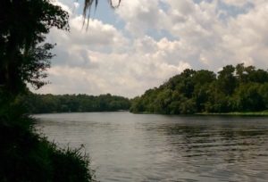
Jupiter Island, like many other jurisdictions, faced a daunting challenge in submitting the necessary paperwork, data tables, and mapping to verify their certification with the National Flood Insurance Program’s community rating system. However, they were struggling due to their limited staff capacity and a lack of time.
Clearview Geographic stepped in and partnered with one of Florida’s leading CRS experts to take on this task. Our team of emergency management and geospatial intelligence experts dug into the national flood insurance rate maps, parcel records, building footprints, and other data sources to complete the mapping and program data table outputs required for the verification process.
But we didn’t stop there. Our team went above and beyond to create the “Jupiter Island Flood Information Portal,” a GIS web app featured on the town’s Flood Information section of their website. This helped Jupiter Island achieve extra credits and score even higher in the certification process.
Florida Floodplain Managers Association: CRS Recognition & Education Support
Our successful collaboration with Jupiter Island has earned us recognition from the Florida Floodplain Managers Association. In a recent thirty-minute course led by Alex Zelenski, we shared our lessons learned and highlighted major requirements and methods of obtaining credits. We also showcased our unique GIS approach to complete the program data table, providing valuable insights to other jurisdictions facing similar challenges.
At Clearview Geographic, we understand the challenges jurisdictions face in obtaining and maintaining certification with the National Flood Insurance Program’s community rating system. Our expertise in emergency management and geospatial intelligence can help your organization navigate these challenges and achieve your certification goals. Contact us today to learn more.
Wetland & Endangered Species Assessment in DeBary
A local property owner did not want to impact water quality or protected wildlife during the construction of their home.…

Mapping Islamorada’s Climate Risks
Our team took on the challenge of providing critical solutions to the climate-driven flood scenarios faced by Islamorada. Through our…
Climate Risk Assessment in Beaufort County
Our team at Clearview Geographic solved a crucial problem for a real estate investment group in Beaufort County, South Carolina.…