Building Resilient, Sustainable Projects with Geospatial Intelligence
Climate Change and the Need for Resilient Development
Climate change is no longer a distant concern—it’s a reality reshaping how we build and invest in real estate and infrastructure. Extreme weather events like floods, hurricanes, and wildfires are growing more frequent and severe, directly threatening properties and communities. In 2023 alone, natural disasters caused an estimated $92.9 billion in property damages across the U.S., just from 28 major events. For private developers, these trends mean that traditional site selection and project design approaches must evolve. Resilience—the ability of a development to withstand and quickly recover from adverse events—has become a critical priority in real estate and infrastructure projects. Embracing resilience isn’t just about safety; it’s also about protecting financial investments and ensuring projects remain viable in the long term. Forward-thinking developers are increasingly seeking ways to “future-proof” their projects against climate risks while meeting growing market and regulatory demands for sustainability.
Amid these challenges, geospatial intelligence has emerged as a powerful ally. Developers can gain deeper insights into a site’s vulnerabilities and opportunities by leveraging advanced mapping and data analysis. This data-driven approach enables proactive strategies, so developers can plan to mitigate risks instead of reacting to floods or heat waves after they occur. In short, building resilient, sustainable projects in the era of climate change requires both a new mindset and new tools. This is where Clearview Geographic’s expertise in geospatial intelligence (GIS) comes into play.
Geospatial Intelligence: A New Tool in the Developer’s Toolkit
Geospatial intelligence (GIS) might sound technical, but its value is simple: it helps you see and understand the many factors tied to a location. GIS involves gathering location-based data—like topography, flood zones, infrastructure, land use, and environmental features—and visualizing it on maps to reveal patterns and insights that aren’t obvious from ground level. Clearview Geographic specializes in translating complex spatial data into actionable intelligence for developers. Think of it as having a “digital lens” on a property: by layering maps of flood hazards, soil types, elevation, population density, and more, GIS provides a comprehensive picture of both risks and opportunities on a site.
Private developers’ decisions are no longer based on guesswork or limited surveys. With Clearview Geographic’s GIS support, you can identify which parts of a land parcel are prone to flooding, which areas contain sensitive environmental habitats, how close essential infrastructure or resources are, and how a development might be affected by future climate scenarios. These insights lead to informed decisions about where and how to build. As Clearview Geographic’s experience shows, geospatial analysis can directly inform strategies like optimal site layout, materials selection, and mitigation measures, taking a project from concept to construction with confidence. In an industry where margins are tight and uncertainties can be costly, geospatial intelligence is a compass, guiding developers toward resilient and sustainable outcomes.
Mapping Flood Hazards to Protect Your Investment
Modern flood hazard maps and data are vital tools for identifying risk zones early in the planning process. Flooding is one of the most immediate climate threats to real estate, and recent years have shown that even “rare” floods can hit unexpectedly. GIS-powered flood hazard mapping gives developers a clear understanding of how water might impact a site, whether from coastal storm surge, river overflow, heavy rainfall runoff, or future sea-level rise. Clearview Geographic uses advanced tools like LiDAR elevation mapping and historical flood data to create detailed flood risk maps for your property. These maps highlight flood-prone zones, show how water flows across the land, and delineate official floodplain boundaries.
With this knowledge, a developer can take proactive steps before shovels hit the ground. For example, if flood maps reveal that the northern portion of a parcel lies in a 100-year flood zone, the site plan can be adjusted to locate buildings on higher ground or incorporate retention basins in low-lying areas. Clearview Geographic’s flood risk assessments go beyond pointing out problems – they also recommend solutions, from elevating structures and improving drainage to restoring wetlands as natural buffers. By identifying flood hazards upfront, developers can design projects that stay dry during extreme weather, avoiding costly damage and construction delays down the line.
Many jurisdictions worldwide require developers to address flood risks to get building permits or approvals. Having clear GIS maps and reports of your site’s flood exposure demonstrates due diligence and helps ensure your project aligns with local and federal floodplain management standards. In short, flood hazard mapping with GIS isn’t just about safety—it’s about smart business. It protects your investment and even lowers insurance premiums by showing insurers that risks are understood and mitigated. When you consider that properties in high-risk flood areas might otherwise face steep insurance costs or value loss, the advantage of proactive flood planning becomes clear.
Sustainable Urban Planning with Location Insights
Building sustainably means finding a balance between development and the environment, and GIS is the perfect tool to strike that balance. Clearview Geographic assists in sustainable urban planning by analyzing many factors about a site and its surroundings. Through geospatial analysis, developers can visualize where the sensitive ecological areas are, how land is currently used, and what the community needs for the future. This holistic view supports design choices that minimize environmental impact while maximizing community benefits.
For instance, before breaking ground on a new residential community, a developer might use Clearview Geographic’s services to map out existing green spaces, waterways, and wildlife habitats on and around the site. GIS maps could reveal a wetland or endangered species area on one corner of the property – a clear signal to avoid building there and perhaps preserve it as a community park instead. By doing a comprehensive environmental assessment with GIS, developers can adjust their plans to protect water quality and biodiversity (for example, by buffering streams or rerouting roads). Clearview Geographic’s team often conducts these assessments as a first step, ensuring projects meet environmental regulations and enhance the local ecosystem rather than harm it.
Additionally, geospatial intelligence helps optimize the layout of infrastructure for sustainability. By analyzing elevation and natural drainage, GIS can inform where to place permeable surfaces or rain gardens to manage stormwater. By mapping sun angles and wind patterns, it can guide building orientation for energy efficiency. And by overlaying demographic and transit data, it helps plan pedestrian paths, public transit access, or renewable energy placements (like the ideal spots for solar panels or EV charging) to serve future residents. All these insights lead to sustainable development planning that aligns with both regulatory requirements and the community’s long-term well-being. The outcome is a project that not only passes environmental approvals more smoothly but also appeals to modern buyers and tenants who value green, resilient neighborhoods. In other words, GIS-driven planning helps developers create places that are built to last and loved by the community.
Climate Resilience Strategies: Planning Today for Tomorrow’s Risks
Sustainability isn’t just about the environment today – it’s about resilience in the face of tomorrow’s climate realities. Proactive developers are now using GIS to implement climate resilience strategies, ensuring their projects remain safe and functional amid changing conditions over the coming decades. Clearview Geographic supports these efforts through climate vulnerability assessments and adaptation planning. This means looking at not only current hazards, but also modeling future scenarios: How might higher sea levels or heavier rainfall in 20, 30, or 50 years affect your development? What measures can be built in now to cope with those changes?
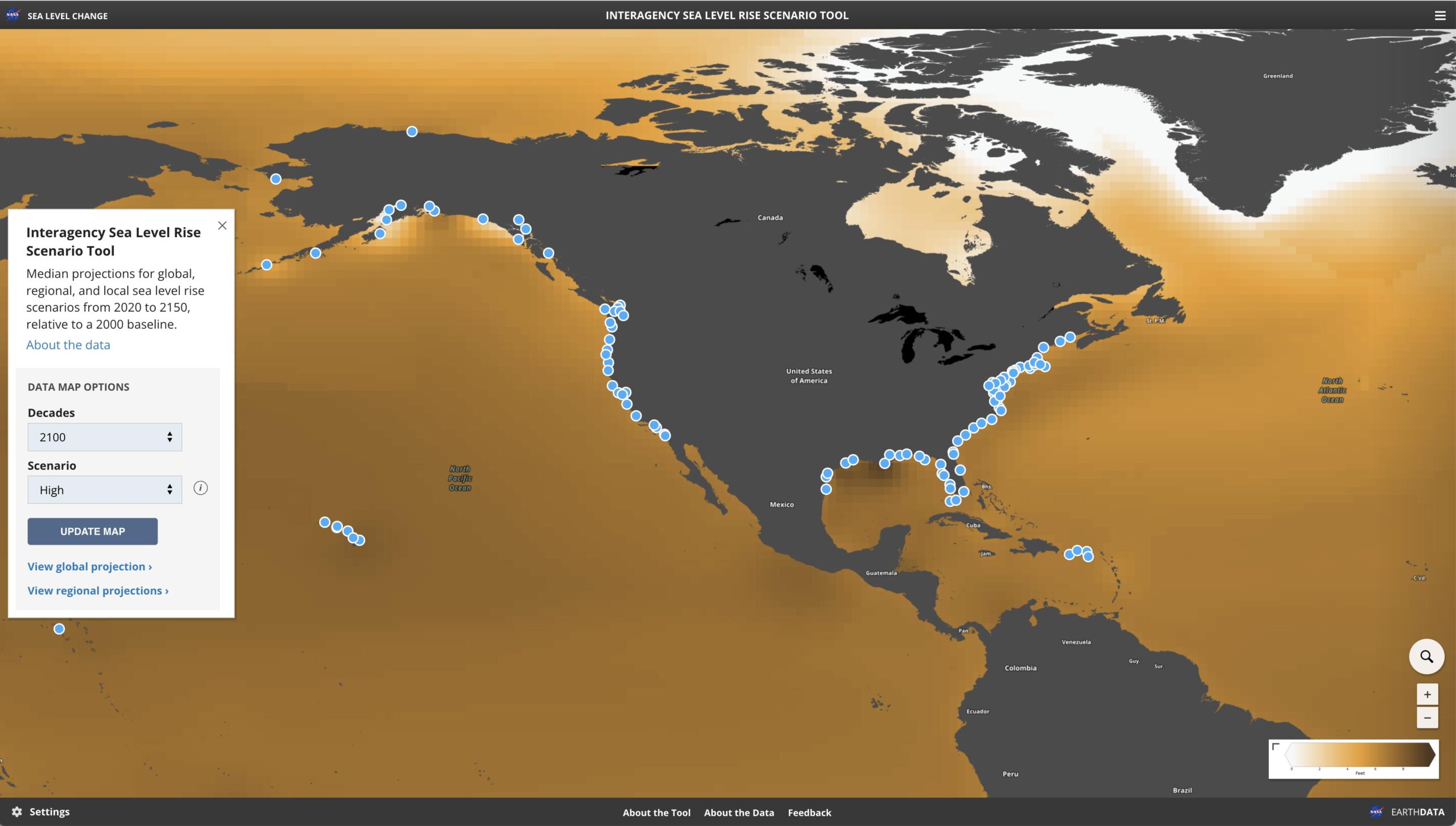
GIS is invaluable for this forward-looking analysis. For example, Clearview Geographic has worked with coastal communities to visualize future flood scenarios by mapping projected sea-level rise and tidal flooding for future decades. In Islamorada, Florida, our team used advanced mapping technologies to pinpoint which neighborhoods would be most vulnerable to regular tidal flooding in 2040, 2070, and even 2100. By doing so, local decision-makers could plan protective measures and adapt their development guidelines accordingly, safeguarding the community’s future. Private developers can apply the same foresight to their projects: if projections show that rising tides or storm surges could impact a planned waterfront development in 30 years, they can invest in elevated foundations, sea walls, or natural barriers today to mitigate that long-term risk.
Beyond flooding, climate resilience planning with GIS can address other risks like extreme heat, wildfire exposure, or storm wind damage, depending on the region. The key is that proactive planning pays off. It’s far more cost-effective to design resilience into a project from the start than to retrofit or repair later. Studies have found that every dollar spent on disaster prevention can save about $4 in recovery costs. Moreover, developments that take resilience seriously tend to hold their value better over time – properties that lack mitigation measures could see significant value declines (one study noted up to 30% decreases). In contrast, resilient, energy-efficient homes often command a premium. By leveraging GIS-based analysis for climate resilience, developers also signal to stakeholders and regulators that their project is built for the long haul. This can ease concerns during permit approvals and attract investors or buyers who are increasingly climate-conscious.
The Payoff of Proactive Planning with GIS
Adopting geospatial intelligence in your development planning isn’t just an added expense or extra paperwork – it’s an investment that yields tangible returns. Here are some of the key benefits that private developers gain from a proactive GIS-driven approach:
- Reduced Financial Risk: By identifying hazard-prone areas (floodplains, erosion zones, fault lines, etc.) early, you can avoid costly mistakes and damage. Preventative measures informed by GIS – whether that’s re-siting a building or reinforcing infrastructure – help you dodge the brunt of natural disasters. In the long run, this reduces repair bills and can even lower insurance premiums, as insurers see that risks have been mitigated. In an industry where margins matter, sidestepping a potential multi-million dollar flood or structural issue is a huge win.
- Smoother Regulatory Approvals: Getting a project green-lit by planning boards and environmental regulators can be a daunting process. However, coming to the table with clear data and maps makes a difference. Geospatial analysis provides evidence that your project design respects floodplain regulations, wetland buffers, and zoning requirements. For instance, Clearview Geographic’s reports often include maps and technical documentation that demonstrate compliance with local and federal standards (like FEMA flood management rules). This speeds up the approval process and builds trust with the community, showing that you’re not “winging it” but have done your homework to ensure safety and compliance.
- Enhanced Long-Term Value: Resilient and sustainable projects simply make for better investments. Properties built with climate risks in mind are less likely to suffer catastrophic losses, making them more attractive to lenders and buyers. Over time, features like flood defenses, efficient drainage, or preserved green space can preserve or even increase property values compared to conventional developments. Market trends back this up: there is rising demand for green, resilient buildings, and data-driven planning helps you tap into that trend. By leveraging GIS to optimize site selection and design, developers can ensure they are putting capital into projects that will stand the test of time and yield stable returns. In short, proactive planning isn’t just good stewardship – it’s good business.
From Insights to Action: Partnering with Clearview Geographic
Resilience and sustainability are no longer optional in development – they’re the new benchmarks of success. The good news is that private developers don’t have to navigate these complexities alone. By partnering with specialists like Clearview Geographic, you gain access to the geospatial intelligence and expert guidance needed to make informed, confident decisions at every stage of your project. Whether it’s a flood hazard mapping for a single site, a comprehensive sustainability plan for a new community, or a climate risk assessment for a portfolio of properties, Clearview Geographic’s team is ready to support your vision with cutting-edge GIS analysis and practical recommendations.
Every successful project starts with good data and planning. Clearview Geographic brings you both – translating climate models, environmental data, and market trends into clear maps, reports, and strategies tailored to your project’s needs. We’ve helped developers perform due diligence on multimillion-dollar investments by visualizing potential tidal flooding before purchase, and we’ve guided urban planners in designing neighborhoods that thrive in harmony with nature. Our approach is collaborative and solution-oriented: we work alongside your team to integrate geospatial insights into actionable plans that reduce risk, satisfy regulators, and create real value for end users.
Ready to build smarter and build stronger? Proactive planning with GIS could be the deciding factor that makes your next development a resilient, sustainable success story. Don’t wait for the next storm or regulation to catch you off guard. Contact Clearview Geographic today for a consultation and let our experts help future-proof your project. With the right intelligence on your side, you can move forward with confidence, knowing that your investment is not only poised for profit but also built to weather whatever the future holds.
Building Resilient, Sustainable Projects with Geospatial Intelligence
Climate Change and the Need for Resilient Development Climate change is no longer a distant concern—it’s a reality reshaping how…
Sea Level Rise Scenario Tool to Visualize Flood Risk
Assessing Flood Vulnerability: How Clearview Geographic Leverages Cutting-Edge Sea Level Data At Clearview Geographic, we understand that effective flood vulnerability…

Join Clearview Geographic at the 2025 Miami Disasters Expo
We are excited to announce that Clearview Geographic will be exhibiting at the 2025 Miami Disasters Expo, March 5-6, 2025,…