Accurate Wetland Mapping for Permitting
Image Source: FreeImages
Wetlands play a vital role in Florida’s ecosystem, providing essential habitats for diverse wildlife, supporting flood control, and improving water quality. However, as the state continues to experience rapid urbanization and development, these fragile environments are increasingly under threat. Accurate wetland mapping is essential to ensuring the protection and preservation of these vital natural resources. In this article, we will explore the critical role of wetland mapping in Florida’s regulatory permitting process and why it is vital to ensure that this data is reliable and up-to-date.
The Consequences of Inaccurate Wetland Mapping
Inaccurate or incomplete wetland mapping data can have serious consequences, leading to costly delays, fines, and environmental damage. For developers, inaccurate mapping data can result in significant delays in the permitting process, as regulators may require additional studies to determine the extent of wetlands on a property. This can result in increased project costs and lost revenue. In some cases, developers may even face fines or penalties for violating wetland protection regulations.
From an environmental perspective, inaccurate wetland mapping can result in the destruction of critical habitats and ecological services. Wetlands provide essential habitat for a wide range of plant and animal species, many of which are threatened or endangered. Inaccurate mapping data can result in the destruction of these habitats, leading to the loss of biodiversity and reduced ecological services such as flood control and water filtration.
The Advantages of Accurate Wetland Mapping
Accurate wetland mapping data provides numerous advantages for both developers and environmental professionals. For developers, accurate mapping data can streamline the permitting process, reducing costs and delays. By providing regulators with reliable data on wetland extent and potential impacts of development activities, developers can avoid costly delays and ensure compliance with wetland protection regulations.
From an environmental perspective, accurate mapping data is essential to ensure the protection and preservation of critical habitats and ecological services. By providing regulators with reliable data on wetland extent and potential impacts, environmental professionals can ensure that development activities are designed to minimize impacts on these vital resources. This can help to ensure the long-term sustainability of Florida’s unique ecosystem.
The Role of Technology in Wetland Mapping
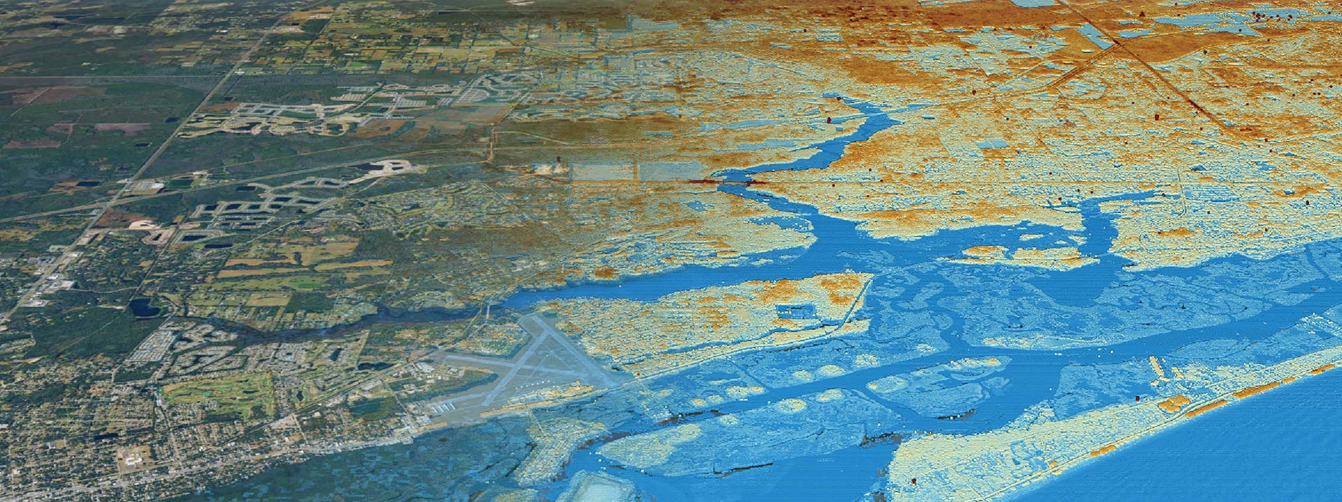
Advances in technology have revolutionized the way wetland mapping is conducted, providing more accurate and reliable data than ever before. Remote sensing technologies such as satellite imagery, aerial photography, and LiDAR can provide detailed information on wetland extent and vegetation cover, allowing for more accurate mapping and monitoring of these critical ecosystems.
Geographic Information Systems (GIS) are also playing an increasingly important role in wetland mapping, providing a powerful tool for visualizing and analyzing complex spatial data. By integrating wetland mapping data with other environmental data such as land use, soil types, and hydrology, GIS can provide a comprehensive understanding of wetland ecosystems and how they are being impacted by development activities.
Best Practices for Wetland Mapping
To ensure the accuracy and reliability of wetland mapping data, it is essential to follow best practices in mapping methodologies. These include:
- Conducting field surveys to verify mapping data
- Using multiple data sources to verify wetland extent and characteristics
- Using standardized mapping protocols and classification systems
- Regularly updating mapping data to reflect changes in wetland extent and characteristics
- Conducting quality control checks to ensure data accuracy and consistency.
By following these best practices, environmental professionals and developers can ensure that wetland mapping data is reliable and up-to-date, reducing the risk of costly delays, fines, and environmental damage.
Wetland Mapping Tools and Resources
A variety of tools and resources are available to support wetland mapping activities in Florida. These include:
- The Florida Geographic Data Library, which provides access to a wide range of environmental data, including wetland mapping data.
- The Florida Wetlands Mapper, which provides access to wetland mapping data for the entire state.
- The National Wetlands Inventory, which provides wetland mapping data for the entire country.
- The US Army Corps of Engineers, which provides guidance on wetland mapping methodologies and mitigation strategies.
By leveraging these tools and resources, environmental professionals and developers can access the most up-to-date and reliable wetland mapping data, reducing the risk of costly delays and environmental damage.
Wetland Mitigation Strategies
In cases where wetland impacts cannot be avoided, wetland mitigation strategies can be employed to minimize the environmental impacts of development activities. These strategies may include:
- Wetland restoration, which involves restoring degraded wetland habitats to their natural state.
- Wetland creation, which involves creating new wetland habitats to replace those lost to development activities.
- Wetland enhancement, which involves improving the ecological functioning of existing wetlands to compensate for lost functions.
By employing these wetland mitigation strategies, developers and environmental professionals can ensure that wetland impacts are minimized, and the long-term sustainability of Florida’s unique ecosystem is maintained.
Wetland Restoration Techniques
Wetland restoration techniques can be used to restore degraded wetland habitats to their natural state. These techniques may include:
- Hydrologic restoration, which involves restoring natural water flow patterns to a wetland.
- Vegetation restoration, which involves planting native vegetation to restore wetland habitat.
- Soil restoration, which involves restoring natural soil characteristics to a degraded wetland.
- Wildlife restoration, which involves reintroducing native plant and animal species to a degraded wetland.
By employing these wetland restoration techniques, environmental professionals and developers can help to restore degraded wetland habitats, providing essential habitat for a wide range of plant and animal species, and improving ecological services such as flood control and water filtration.
Protecting Florida’s Wetlands for Future Generations
Accurate wetland mapping is essential to ensuring the protection and preservation of Florida’s unique ecosystem. By providing reliable data on wetland extent and potential impacts, developers and environmental professionals can ensure that development activities are designed to minimize impacts on these vital resources, reducing the risk of costly delays, fines, and environmental damage. By following best practices in mapping methodologies, leveraging the latest mapping tools and resources, and employing wetland mitigation and restoration strategies, we can protect Florida’s wetlands for future generations, ensuring the long-term sustainability of this vital ecosystem. Call us if you need help!


