Working in collaboration with Victoria Colangelo, Clearview Geographic, LLC. developed the Mitigation Bank Search utility for The Mitigation Banking Group, Inc. and those interested in mitigation banking services. The application was developed using ArcGIS Online and data provided by the Florida Department of Environmental Protection, the United States Army Corps of Engineers, and the Water Management Districts.
How to Use the Dashboard

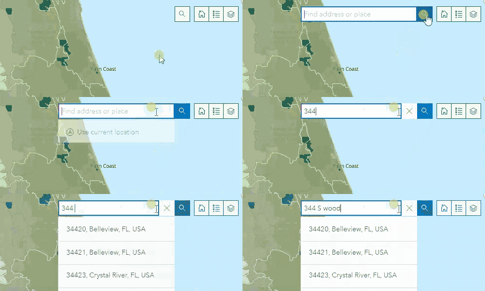
1. SEARCH – Type an address into the search bar, hit enter, and the map will zoom onto that location.

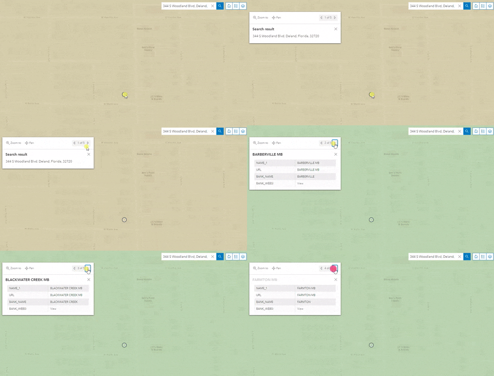
2. REVIEW – The left and right fields will display the State and Federal Mitigation Banks, WMDs, Drainage Basins, and Hydrologic Unit Codes for the selected area. (On the mobile version, these will appear on the top and bottom.) Clicking on the address point creates a pop-up where users can cycle through more detailed information about the service areas an address falls in.

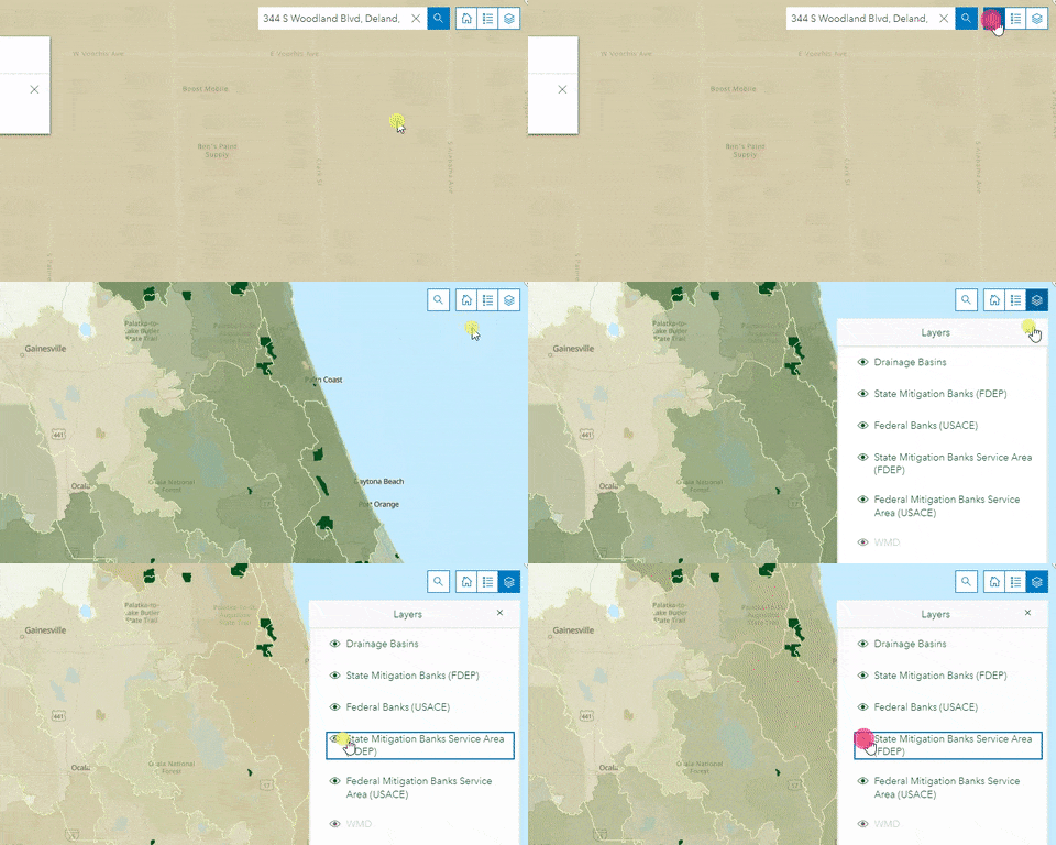
3. RETURN – Click the home button to return to the state-wide view. The other icons allow users to view the legend and toggle layers on the map.
Definitions
A Water Management District, or WMD, is a region defined by the Florida Department of Environmental Protection charged with administering water supply and protecting water quality. WMDs also manage floodplains, implement plans to protect against flooding, and protect natural water systems. Learn More
A Hydrologic Unit Code, or HUC, is a sequence of numbers intended to identify a hydrological feature such as lakes, rivers, or drainage basins. Learn More
A Mitigation Bank Service Area is a geographic area served by a permitted mitigation bank. Learn More
Drainage Basins, also known as watersheds or catchments, are geographic areas where precipitation collects and flows to a common hydrologic feature such as rivers, creeks, or lakes. Learn More
